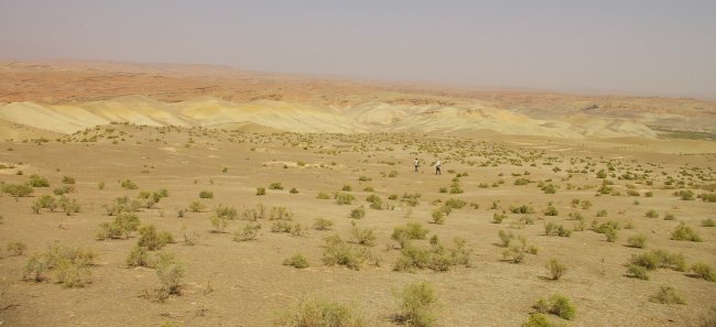
The activities in Uzbekistan in the 2008 season: testing the Google Earth programme as a tool for archaeological prospecting
Ladislav Stančo
Published in: Studia Hercynia XIII
should be cited as follows:
Stančo, Ladislav 2009: The activities in Uzbekistan in the 2008 season: testing the Google Earth as a tool for archaeological prospecting. Studia Hercynia XIII, pp. 115-122, Pls. 60-62.
Key words: archaeological survey; Central Asia; Bactria; Google Earth; satellite imagery
Summary: By analysing satellite pictures of Sherabad district in southern Uzbekistan in free available Google Earth software we managed to detect, during a short time over an area of approximately 22 x 25 km, several dozen features which might be considered archaeological sites, plus a number of uncertain features. In all, there were 150 different features, many of them previously archaeologically unknown. The verification in the field proved positive (settlements) as well as negative results (supposed irrigation system).
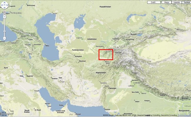
In 2008 some of the planned activities of Charles University's Institute for Classical Archaeology in southern Uzbekistan were postponed for lack of funds. As part of the preparations for a new and complex project, however, the possibility of using cheaper detection methods for the needs of archaeological geography was tested. The use of satellite pictures in archaeology, above all in archaeological prospecting, does not need to be described. The analysis of satellite pictures is now a totally normal tool for detecting anthropogenic features and the creation of archaeological maps. There is no doubt as to the possibilities of the use of such pictures and of their significance for archaeology, but many of them have one serious shortcoming for the ordinary user: they cost a lot to make. One of the alternatives is the freely-accessible application Google Earth.
1. Google Earth
The software application Google Earth, essentially a virtual globe,, was launched by Google in October 2005. In addition to the basic, free version, a higher version, G.E. Plus was available last year at a cost of USD20 per year. Now, however, only G.E. Pro can be bought (USD400 per year). What it chiefly provides is higher-quality printouts, direct support for GPS and also the possibility of importing GIS data, which is an attractive feature for future use (the Pro version can be trialled for free for 7 days). My experience suggests that the freely-available version is sufficient for the needs of archaeological prospecting. One of the important qualities of the pay-for version - communication with GPS - can easily be replaced by the use of freely-available utilities (such as Free KML to GPX Converter) These transform files exported in KML format into GPX format, which can be used for ordinary GPS. G.E. is based on the World Geodetic System, 1984 (WGS 84). The resolution varies considerably from area to area, from the basic (15 m) which is used globally for the whole planet, to the very detailed (0.5m). Certain areas are even covered by orthophotography (aerial photographs) with high resolution (0.1m). It should, however, be added that fast and comfortable work with Google Earth requires a fast computer if possible. A high-speed internet connection is also essential, since the pictures consist of large volumes of data that is continuously downloaded during work. Actual work with the program is very easy, and its operation is intuitive. In addition to moving around over the selected section of the earth's surface, we can zoom in, and set the picture to horizontal. This means that with the setting on a reasonably pronounced relief, the impression of a 3D model of the landscape can be gained. For detecting anthropogenic features the best view is that from above, although an oblique view can also be used in certain specific cases. The picture may also be rotated at will. It is also possible to try out less detailed detection by "flying" slowly back and forth over the landscape. A very important tool is the ability to save places, with detailed data on them, and export current pictures in the form of JPG pictures. Detailed descriptions of how to operate G.E., system requirements and the basic use of G.E. for archaeology have already been published (MADRY 2006; BOUSMAN 2006; UR 2006).
2. The area of landscape tested
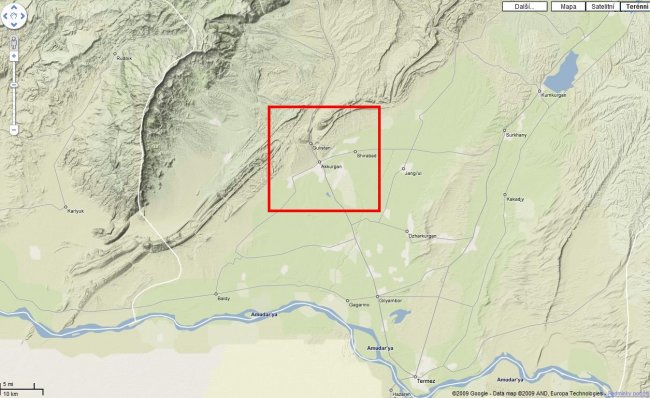
Several of our institute's projects involve long-term exploration of the area of northern Bactria, now southern Uzbekistan, above all the region around the town of Sherabad - the Sherabad oasis (q.v. the season reports in Studia Hercynia VII-XI). The area consists of two types of landscape - an intensively-farmed agricultural plain to the south, and barren mountains and foothills to the north. The first part - the plain - is relatively well known to archaeologists, largely as the result of the efforts of Soviet, later Russian and Uzbek, researchers, with many sites having been explored. At many sites, basic surface collections have been made or stratigraphic sections opened. As part of long-term expeditions, mostly in the 1970s and 1980s, archaeologists who undertook "intuitive" or haphazard archaeological prospection were put to work on them. The problem with using today the results gained back then is the (lack of) geographical quality of the archaeological data collected.The localisation of the settlements is imprecise or wrong, the archaeological maps are very general, and the data published hitherto provides a very uneven and unreliable picture of land settlement and use. The area that we have chosen for this project has thus been chosen both because we have a long-term interest in this region and because, unlike some other regions of Bactria or Sogdiana,complex archaeological and geographical treatment of this area is as yet totally insufficient. Because we were only testing a method, it was not, from the start, a detailed analysis of the whole area of interest. The part in the foothills was explored in the theoretical part in a fairly detailed and systematic manner, but the mountain part was explored only haphazardly. The landscape in the area of interest has significant characteristics. Both on the cultivated plain and in the barren foothills there is a total absence of forest cover. At the most, there are several trees together, but only close to human settlements where they have been artificially planted, and profit from the irrigation of gardens and small fields. This situation clearly aids both aeroplane and satellite prospection. The fertile parts of the Near and Middle East, as well as the whole of Central Asia, typically have multicultural settlements, with areas that have often been used for whole millennia (known as tell or tepe/tepa). Many of them are several metres high, and sometimes they are as high as 20 or 30 metres. They are then very easy to see on a satellite picture in the treeless landscape, and are unmistakeably recognisable.
3. Goals
Our long-term goal is to create a high-quality archaeological map of the region on the basis of GIS and the use of published data, satellite pictures and field prospection. This contribution is designed to show one of the aspects of the project - the use of newly-available satellite pictures in Google Earth for the localisation of anthropogenic features in the landscape and their verification on the ground, and the possibilities of their interpretation. The short-term aim is to examine the suitability of this tool for use in further complex work.
4.0 Procedure
The first step was to "walk over" the area in question using G.E., which happened as soon as the higher-definition picture was made available in March 2008. This work lasted a mere 7-8 days. During it we looked at a segment 22 by 25 km, with its centre 2 - 3 km to the south of the town of Sherabad. We used the then-current Google Earth software version 4.3.7204 from March 2008. In the older versions, the region in question had been covered by low-resolution pictures. Starting with version 4.3, the Sherabad district has been covered by high-resolution pictures. Currently (March 2009) Google Earth version 5.0.11337 is available, but the quality of pictures is identical to the previously-mentioned one. All the features in the landscape of a potentially historical or anthropogenic character were noted, and an analysis of them was started. A catalogue of archaeological sites in the Sherabad region was then created. I did not intend it to cover, in exhaustive fashion, archaeological sites that were already known or explored, but only those that had been detected with the aid of G.E. Data from older literature was included alongside them, however. The aim of this was merely to permit the identification of sites detected with those that were already known, in order to ascertain more precisely the position of the latter.
4.1 Catalogue of archaeological objects
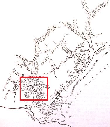
A total of 47 presumed settlements on the plain and 7 complexes of features in the foothills (presumed to be burial mounds) were included in the catalogue, as well as several dozen features that were highly likely to have arisen in connection with human activity. In all, almost a hundred features that may be considered archaeological sites were ascertained in the Sherabad oasis and the adjoining northern foothills, plus a further 40 unclear features (Fig. 1).

It should be added that Rtveladze, in his archaeological map from 1974, shows a total of 28 sites in the Sherabad oasis (RTVELADZE 1974, 74-78). For each site, two pictures were downloaded from Google Earth: one detailed one (the modelled height from the surface to around 500-600 m) and the second also including part of the surrounding area for easier orientation (modelled height from the surface to 1 - 1.5 km). In addition to the pictures, the catalogue also contains precise data on position, the approximate height above sea level, the dimensions of the site (all these data gained from G.E.) and, where relevant, references to literature, topographical maps etc. In the case of sites which we believed were probably burial grounds, there are also details of the individual objects (presumed burial mounds): position, dimension, height above sea level. As well as the grid references of the features detected, the routes of presumed optimum access to them were also indicated, with an emphasis on logistical economy. As a test sample of the detected phenomena we preferred to choose clusters rather than spatially-isolated phenomena. Data from Google Earth in KML format was transferred into GPX format and saved to a pocket-sized GPS receiver. For our purposes we used a standard walker's instrument, the GARMIN eTrex Vista C.
4.2 Field survey
The on-the-ground part of the project took place in September 2008 in southern Uzbekistan. In addition to the author, Uzbek archaeologist Alisher Shaydullaev participated in it and was of invaluable help, especially in communicating with the local population. From 14-18 September 2008, short prospecting journeys were carried out in the vicinity of the town of Sherabad, the aim of which was to confront the data gained from the satellite pictures in Google Earth with the actual state and character of the features on the ground. As has already been said, the goals were chosen not systematically, but with regard to the various conditions and environments in which they appear, and also with regard to logistics. We therefore chose several mountain and several lowland locations. Some of them are known, some of them are even being or have been explored by archaeologists, while others are as yet unwritten about. Most of the localities on the plain are easily accessible by car, but the "mountain" site are, with a few exceptions, hard to access, and have to be approached on foot (or horse, donkey or in a heavy all-terrain vehicle). The best example with which to demonstrate our procedure in the foothills is the valley of Jida Bulaq Say.
4.2.1 Jida Bulaq Say
Analysis of the pictures showed a very promising area in the foothills, to the north of Sherabad and in the vicinity of the village of Kalamazar. This was the valley of the stream Jida Bulaq, where we detected and later verified on the ground two entirely unknown archaeological sites, given the working names of BG Sh001 and BG Sh002 (Fig. 2-6).


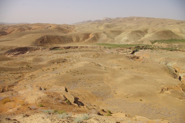
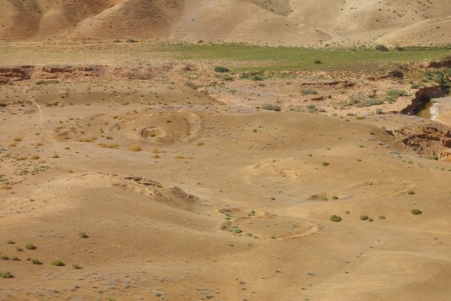

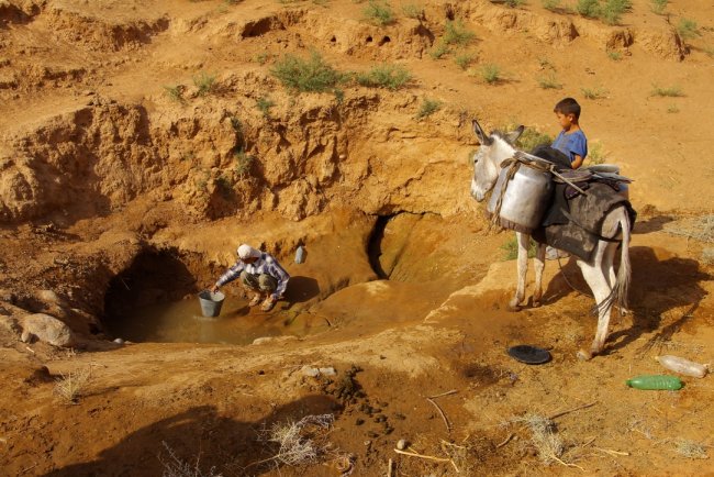
As well as verifying the data gained from G.E., we also monitored other key features in the area - springs. In the Jida Bulaq Say valley we discovered two freshwater springs, although the main stream itself is saltwater. This is a good example of the limits of G.E. (and other) satellite pictures: we would not have been able to find the spring reliably in any way other than by classic field prospecting. It is not practically possible to follow the course of streams on a satellite picture in this type of terrain. There are very many dry or seasonal water courses, and gulleys with streams cannot be differentiated from ones without. Ceramic material collected at site BG 001 indicates that it was in use over a long period. There are ceramics from the Kushan period (2nd-3rd centuries A.D.), mediaeval ceramics and modern-era porcelain. The ceramic material found at BG 002, on the other hand, shows that it was used at only one time. The ceramics here come from the mediaeval - early modern period. We noted similar features, indicating a temporary settlement, on the eastern fringe of the village of Kalamazar, but unfortunately no ceramics were found there.
4.2.2 Presumed irrigation systems
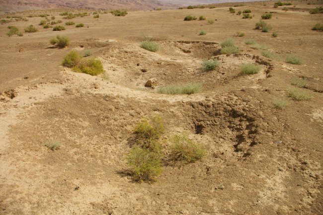
Let us return to the features that looked like smallish hollows, which showed up very clearly on G.E. and formed long lines in the areas of the dry foothills (Fig. 9).

My working theory was that they might have formed part of irrigation systems, although the way in which they functioned was unclear. I based this on knowledge of one such system in the valley of Ulan Bulaq Say near the village of Goz (about 20 m to the west of Kalamazar and Sherabad). These are reminiscent of reduced-size manawars. After looking at the features on the ground, and in consultation with the two local archaeologists, it became apparent that in reality they were relatively recently made, having been dug by soldiers during military exercises.
4.2.3 Settlements on the plain
We looked at a number of sites on the plain (Fig. 7, 8), most of which are already known to archaeologists.

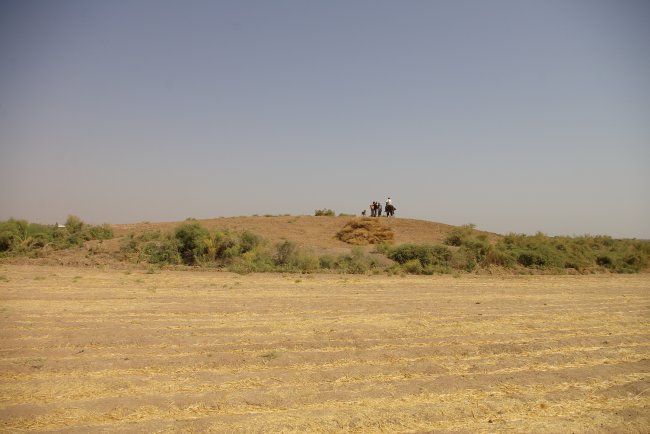
Nevertheless, it would have been extremely difficult to actually find these sites without preparing navigation to them using G.E. The fieldwork also showed how densely the Sherabad oasis is populated. Although the surrounding terrain is totally level, it is usually possible to see from one locality to another. Their accumulation also clearly shows that the extent of the ancient irrigation system differed from today's - it was markedly smaller. The distribution of the settlements on the map shows that in the Sherabad area they are concentrated in a belt of 10-15 km from the edge of the hills. There is also a distinct border, running in a north east - south west direction, behind which there are almost no sites, and where the old irrigation system does not seem to have reached at all. This theory must still be verified, however, since it may be due to the lower resolution of the satellite images - the border of high resolution picture is 14 km to the east, 15 km to the south and 12 km to the west of Sherabad. Another important fact is that the river Sherabad Darya is saltwater, and thus unsuitable for people and agriculture. Today water is brought in from the neighbouring valley of the river Surkhan, and it is clear that similar treatment must have been needed in the ancient and early mediaeval period. With regard to settlements of the tepa type - multicultural settlements at a notable height - it is almost 100% guaranteed that they can be caught on a satellite picture. Our experience of the Jandavlattepa microregion shows, however, that in addition to these settlements, dominant in both area and height, there were also many sites that were used for a shorter time, maybe just for one historical period or even less. These have a minimal chance of showing up on a satellite picture. We cannot operate with concrete numbers, but through comparison it is possible to conclude that there may be several times as many of these sites as there are settlements of the tepa type. Within a radius of one kilometre from Jandavlattepa, at least four further sites can be found that are not at all noticeably clear on the satellite pictures. With the help of Google Earth and other partial images, therefore, we can put together a map that serves as a foundation, but a detailed picture of land use can only be gained in combination with other methods, above all analysis of old military maps (drawn up before the area was touched by the deep ploughing of collectivisation) and classical field prospecting.
4.2.4 Burial grounds
The localisation of burial grounds remains a specific problem. The only burial grounds that can be easily found on satellite pictures are modern-era ones, since these often make use of the only elevated surfaces in the vicinity of the villages, the above-mentioned archaeological sites of the tepa type. On the pictures many of them show up as waves of small mounds, which are the individual graves, crowned by a small chapel. From older research we know of the necropolises from the late Bronze Age, above all Jarkuta and Bustan, but the intervening period represents some two and a half thousand years with no apparent burial grounds. Here it has to be stated that detecting new burial grounds, and thus filling in one of the blank spots on the archaeological maps to date, with the help of pictures from G.E. has not proved to be possible. The reason is clear. For most of the historical periods, in the general area of Bactria the dead were buried by means of inhumation in relatively shallow graves. Such necropolises, or at least what was left of them on the surface, doubtless fell prey to deep ploughing. Here we should return to the foothills of Kugitang. Most of the features that I detected with the aid of G.E. in this dry, fairly high area, I considered to be traces of burial grounds. Round objects with diameters of between three and twelve metres were clearly visible. This was the standard size of kurgans, the burial mounds of the steppe nomads. As has already been indicated in part 4.2.1, these preliminary interpretations turned out to be incorrect, with a few exceptions that still need to be further verified (some of the objects in BG002, Fig. 6)
In both types of natural environment in the Sherabad district - the low plain with irrigation systems, with a settled population, and the dry, upland foothills, used by nomads who kept small livestock - there is as yet almost no evidence of protohistorical and early historical burial sites.
5. Conclusion
In conclusion, by analysing satellite pictures in G.E. we managed to detect, during a short time over an area of approximately 22 x 25 km, several dozen features which might be considered archaeological sites, plus a number of uncertain features. In all, there were 150 different features.
• On the plain a large number of settlements were discerned, and no burial sites.
• Some of them were identified as sites already known, while several were new discoveries.
• In the foothills, several previously-unknown settlements/burial sites were detected.
• The fieldwork for the project brought positive verification of some of the data gained, and also supplemented it.
• In a number of cases we had to correct our original interpretations - what we thought were burial sites turned out in some cases to be the remnants of temporary settlements (shacks, yurts).
• In the case of features that we thought were traces of irrigation systems, verification showed that this was not at all the case, and that they were recent trenches from military exercises.
In any event, the use of Google Earth to detect anthropogenic features was shown to be a very useful tool for archaeological prospecting. Certainly, the results may vary significantly, but for the landscape that predominates in Central Asia - dry and unforested - it is a very effective method. Naturally, the significance of these aids rises rapidly in areas where there is little or no documentation in the way of maps. In the introduction I mentioned articles that describe the possibilities of its use in archaeology, including Madry's article with experience from France (MADRY 2006). Since that was published, G.E. has also started to be used in Central Asia, as s shown by Thomas and Zipfel's use of it in southern Afghanistan (THOMAS - ZIPFEL 2009). There are certainly many other examples of its use that have not yet been published. We shall continue to use G.E. as we proceed to draw up archaeological maps of the Sherabad oasis and its surroundings (let us not forget the dynamics of its development and gradual improvement in picture quality!) and the results of G.E. analysis will be combined with analysis of pictures from the CORONA satellite and other sources. All these data will be integrated into a GIS database and further analysed.
Bibliography:
ANNAEV, Tokhtash (1988): Rannesrednevekovije poselenija severnogo Tokharistana. Tashkent.
BOUSMAN, C. Britt, (2006): Satellite archaeology for everyone. SAA archaeological record, 6 (3), pp. 32-34. Retrieved March 21, 2009 from <http://www.saa.org/Portals/0/SAA/Publications/thesaaarchrec/may06.pdf>
JURKEVICH, E.A. (1965): Gorodishche kushanskovo vremeni na teritorii Severnoy Baktrii. Sovetskaya Archeologija 4.
MADRY, Scott (2006): An Evaluation of Google Earth for Archaeological Exploration and Survey,Digital Discovery Exploring New Frontiers in Human Heritage. CAA 2006 - Computer Applications and Quantitative Methods in Archaeology. Proceedings of the 34th Conference, Fargo, United States, April 2006, pp. 329-337. in: Clark, Jeffrey T., Hagemeister, Emily M., eds.,
MANTELLINI, Simone (2003): The Dargom Canal and the Early Settlement of the Middle Zeravshan Valley. In: Pagani, S., ed., Italo-Uzbek Scientific Cooperation in Archaeology and Islamic Studies: An Overview. Papers from the International Conference (Roma), pp. 42-47.
MANTELLINI, Simone – RONDELLI, Bernardo (2004): Methods and Perspectives for Ancient Settlement Studies in the Middle Zeravshan Valley. The Silk Road Newsletter 2(2). Retrieved March 20, 2009 from <http://www.silk-road.com/newsletter/vol2num2/Zeravshan.html >
MANTELLINI, Simone – RONDELLI, Bernardo – STRIDE, Sebastian (2008): Analytical Approach for Representing the Water Landscape Evolution in Samarkand Oasis (Uzbekistan). Retrieved March 20, 2009 from <http://www.scribd.com/doc/7364675/ Mantellini-Rondelli-Stride-CAA2008> MANTELLINI, Simone – RONDELLI, Bernardo – STRIDE, Sebastian (2009): Canals versus Horses: Political Power in the oasis of Samarkand. World Archaeology 41 (1), pp.73–87.
PIDAEV, Shakir (1978): Poseleniya kushanskovo vremeni severnoy Baktrii. Tashkent.
PILIPKO, Viktor Nikolayevich (1985): Poseleniya severo-zapadnoy Baktrii. Ashkhabad.
RTVELADZE, Edvard Vasilyevich (1974): Razvyedochnoe izuchenie Baktriyskych pamyatnikov na yuge Uzbekistana, in: Masson, Vadim Michailovich, ed., Drevnyaya Baktriya, pp. 74-85. Leningrad: Nauka.
RTVELADZE, Edvard Vasiljevič (1976): Novyje drevnyebaktriyskie pamyatniki na yuge Uzbekistana. In: Masson, Vadim Michailovich, ed., Baktriyskiye drevnosti, pp. 93-103. Leningrad: Nauka.
RTVELADZE, Edvard Vasiljevich – Chakimov, Z.E. (1973): Marshrutnye issledovaniya pamjatnikov severnoj Baktrii, in: Pugachenkova, Galina Anatolyevna, ed., Iz istorii antichnoy kul´tury Uzbekistana, pp. 10-34. Tashkent: Izdatelstvo literatury i isskustva im. Gafura Gulyama.
SEDOV, Alexandr Vsovolodovich (1987): Kobadian na paroge rannego srednevekov´ya. Moskva: Nauka.
STAVISKIJ, Boris (1986): Les sites archéologiques de la Bactriane d´époque kushane et leur répartition géographique, in: La Bactriane sous les Kushans. Problèmes d'histoire et de culture, pp. 57-99. Paris: Librairie d'Amérique et d'Orient Jean Maisonneuve.
STRIDE, Sebastian (2005): La Géographie Archéologique de la Province du Surkhan Darya (Bactriane du Nord, Ouzbékistan du Sud). University of Paris. 5 vols. Retrieved March 9, 2008 from <http://www.silkrode.org/SilkRoDE/space/WikiPage.Thesis..Phd_Thesis> (March 3, 2009 not available!)
STRIDE, Sebastian (2007): Regions and Territories in Southern Central Asia: What the Surkhan Darya Province tells us about Bactria, in: Herrmann, Georgina, Cribb, Joe, eds., After Alexander: Central Asia before Islam. Themes in the history and Archaeology of Western Central Asia. The British Academy,23-25 June 2004. Proceedings of the British Academy 133, pp. 99-117.
THOMAS, David, ZIPFEL, Claudia (2009): A new look at Bust: Google Earth™ and archaeological sites in Afghanistan. WAC poster. Retrieved February 20, 2009 from: <http://www.wac6.org/livesite/posters/poster_files/WAC_065_Thomas_Zipfel.pdf>
UR, Jason, (2006): Google Earth and Archaeology. SAA archaeological record, 6 (3): 35-38. Retrieved March 21, 2009 from <http://www.saa.org/Portals/0/SAA/Publications/thesaaarchrec/may06.pdf>
List of illustrations:
Fig. 1 General satellite image of the Sherabad oasis taken from Google Earth with marked anthropogenic features (eye altitude 36 km).
Fig. 2 Jida Bulaq Say valley north of Sherabad and newly detected archaeological sites.
Fig. 3 Site “BG Sh001” as seen on the satellite image (eye altitude 900 m).
Fig. 4 Jida Bulaq Say with the site “BG Sh001”. Fig. 5 The site “BG Sh001”.
Fig. 6 The site “BG Sh002” (eye altitude 940 m).
Fig. 7 The site “Tepa Sh013” (eye altitude 755 m).
Fig. 8 The site “Tepa Sh013”.
Fig. 9 Supposed irrigation system in the foothills of Kugitang, turned to be recent trenches from military exercises.
Examples of the types used are IKONOS (max. resolution 0.82 cm, used by Microsoft and Yahoo), OrbView-3 (max. 1 m), QuickBird (max. 0.6 m), ASTER, EO-1, Landsat TM7 (15 m) ETM and SPOT (max. 2.5 m). For technical descriptions and the possibilities of different satellites see http://www.satimagingcorp.com/
Google Earth does, after all, use pictures from the satellites Landsat 7, QuickBird and SPOT, and since September 2008 has used the slightly lowered resolution of the best commercial satellite to date, GeoEye-1 (max. 0.41 m, for Google 0.5 m). In 2011 or 2012 we can look forward to GeoEye-2 with a resolution of 24cm!
Google Earth is not the only product of this type. NASA offers the rival World Wind, but this does not reach either G.E.'s resolution or its other parameters. For a comparison see BOUSMAN, C. Britt, 2006.
KML = Keyhole Markup Language, GPX=GPS eXchange Format.
From the literature and the personal reminiscences of those who participated it is clear that most of the prospecting activities were based on the traditional walking up and down the land and asking questions of local inhabitants. Nevertheless, it brought a number of fundamental discoveries. See chiefly JURKEVIČ 1965; RTVELADZE 1974; idem, 1976; RTVELADZE – CHAKIMOV 1973.
An example of "navigation" to a site found is a short text relating to the Mazarbabatepe locality. It is apparently located "on the land of the V.I. Lenin collective farm, 300 m to the south of the Karl Marx school", RTVELADZE 1974, 76. More detailed and precise navigation to archaeological sites could in many countries be counterproductive, given the increase in the number of sites being robbed. In Uzbekistan, however, the character of the artefacts usually found has not yet stimulated illegal activities, as has been the case in the Mediterranean, for example. More precise localisation would in general be more of an asset.
In Surkhan Darya itself the smallish region in the basin of the river of the same name has been dealt with in detail by S. Stride. He has also worked the whole area (including our region) into the basic GIS. See STRIDE 2004; idem, 2005.
The basin of the river Zerafshan, now the Samarqand region, was once the centre of Sogdiana. In recent years it has been the subject of intensive work by an international team (Italy, France, Japan, Uzbekistan etc.) trying to create detailed archaeological maps with the use of satellite pictures, all the available maps and land prospecting. See e.g. MANTELLINI 2003; MANTELLINI – RONDELLI 2004; MANTELLINI – RONDELLI – STRIDE 2008; MANTELLINI – RONDELLI – STRIDE 2009.
The current geopolitical situation in the region does not favour aerial prospecting. Sherabad is within flying range of the Turkmen, Tajik and above all Afghan borders, even with a small plane. It is a very sensitive area, which only a few years ago was very hard for foreigners to access. Our attempt in 2005 to arrange a largish crop-spraying type of plane from which to take test photos ended in failure. German colleagues had managed the same thing ten years earlier, but it later caused a huge scandal.
For example, the objects that I had originally thought were irrigation channels. In addition to those 47 settlements, there are a further 30 similar, although uncertain, features in the lowlands. They all need to be verified individually. Even taking into account the assumed channels and other doubtful cases, 140 different features were indicated.
They are not mountains in the proper sense of the word. We were mostly between 500 and 700 metres above sea level, so in the foothills.


